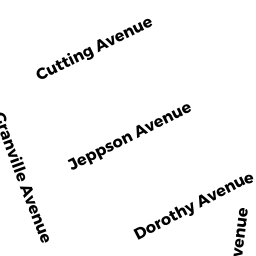
9 DOROTHY AVE
Owner Information
CARON,LYNN + RICCIARDI,RICHARD F
5 PRIMMETT LN
WORESTER, MA 01609


Property Details
9 DOROTHY AVE is classified as a Single Family Residential (Colonial).
The primary structure on this property was built in 1927. There are 3,692ft2 of built area within this property. There is 1,726ft2 of residential/living space within this property. This property is listed as having 7 rooms.
9 DOROTHY AVE is valued at $277,800. The land is valued at $65,400 and the structures are valued at $204,900. There is an additional valuation of $7,500 on this property.
This property is in Zone RL-7. Confirm with local Zoning Board authorities to ensure there are no overlays or other easements on this property.
The most recent deed for 9 DOROTHY AVE is recorded at the local registrar in Book 64529, Page 66. 9 DOROTHY AVE was last sold on Tuesday, February 23, 2021 for $1.
Assessment data from fiscal year 2021.
Flood Data
According to the FEMA National Flood Hazard Layer, this property does not appear to be in a flood zone. It may also be in an area not yet reviewed. Nonetheless, confirm this information prior to taking any action.
To view the flood hazards around this property, create a FEMA "Firmette" Map of the area around 9 DOROTHY AVE.
Broadband Internet Providers
| Provider | Type | Bandwidth (mbps) | |
|---|---|---|---|
| Viasat Inc | Satellite | 100 | 3 |
| VSAT Systems, LLC. | Satellite | 2 | 1 |
| HughesNet | Satellite | 25 | 3 |
| GCI Communication Corp. | Satellite | 0 | 0 |
| Charter Communications Inc | Cable | 940 | 35 |
| Verizon New England Inc. | DSL | 15 | 1 |
Broadband service provider data from December 2020.
Adjacent Properties
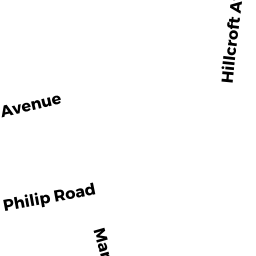
- 61 HILLCROFT AVE
Two-Family Residential owned by LEBOW,JOHN S + JILL GREEN - 67 HILLCROFT AVE
Single Family Residential owned by JENSEN,DONALD A - 7 DOROTHY AVE
Single Family Residential owned by HINCHEY,LAUREN - 11 DOROTHY AVE
Two-Family Residential owned by LOPEZ,MERCEDES - 193 WHITMARSH AVE
Single Family Residential owned by JEAN E MCNERNEY